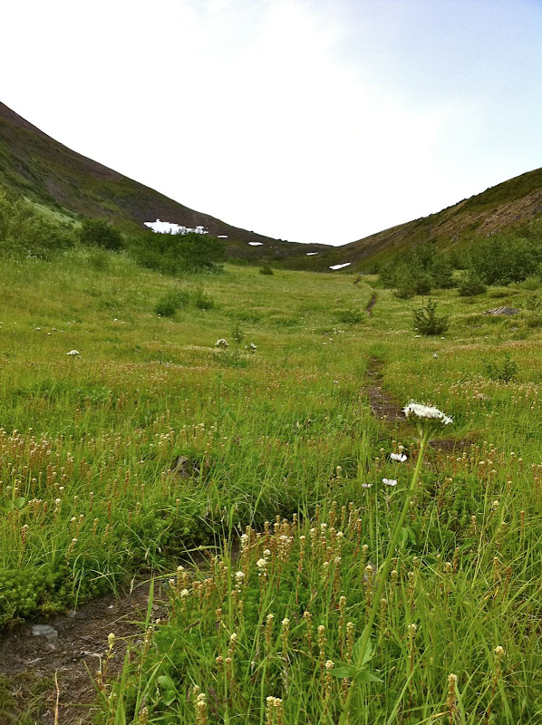
Another great ridgeline in Chugach State Park, excellent views of the front range.
Click here for a full screen version.
Thanks to Ian and Josh for waiting for me. Not my best day.
From the FasterSkier archive — posts syndicated from athletes’ and coaches’ own blogs between 2004 and 2012, kept online as published. Current coverage is at fasterskier.com.
Another great ridgeline in Chugach State Park, excellent views of the front range.
Click here for a full screen version.
Thanks to Ian and Josh for waiting for me. Not my best day.
Another great ridgeline in Chugach State Park, excellent views of the front range.
Click here for a full screen version.
Thanks to Ian and Josh for waiting for me. Not my best day.
Another great ridgeline in Chugach State Park, excellent views of the front range.
Click here for a full screen version.
Thanks to Ian and Josh for waiting for me. Not my best day.
Another great ridgeline in Chugach State Park, excellent views of the front range.
Click here for a full screen version.
Thanks to Ian and Josh for waiting for me. Not my best day.
The alarm clock crowed rudely at 4:00 AM. On a Saturday. I fought back by hitting the snooze bar a couple of times.
The Penguin Ridge hike has been on my to-do list for a long time. Tim Kelley first recommended it to me years ago. Like many other local Chugach hikes, I always figured that some weekend, when I had a little extra time, I’ll knock it off my list. But, funny thing, when you have two little rugrats there is never “extra time.” I decided to start at an ungodly hour, so that I could be back on Dad duty by lunch. I left the Bird Creek parking lot just after 5:30 AM.
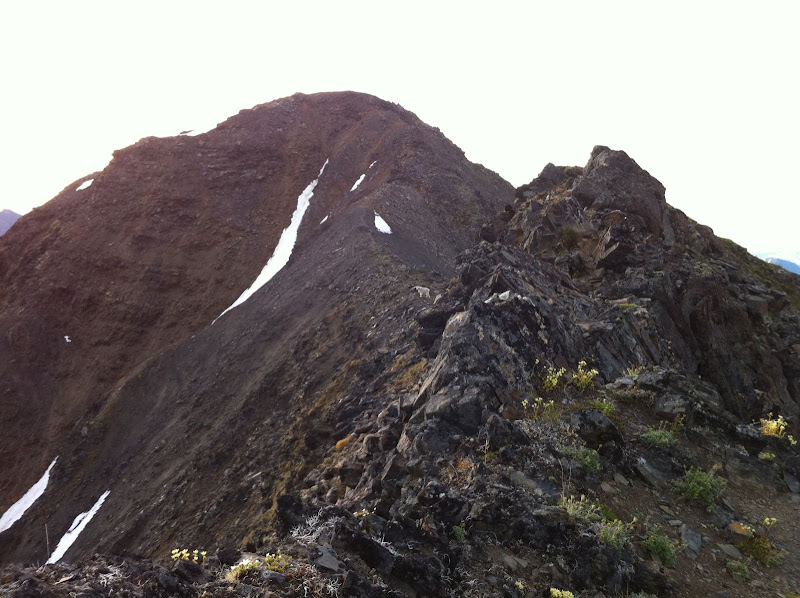
I knew from previous reports that this ridge offered a lot more vertical and a lot more scrambling than what you can see from the road. But even so, I was surprised how much scrambling there was. I thought that once I got a mile or two past Penguin Peak, I’d be tundra-running the rest of the way. Nope. I should have known better – after all this is the Chugach. The ridge is narrow, rocky and loose enough that you need to go slow, watch your footing, and occasionally scramble, all the way from Penguin Peak until you are directly above the Girdwood turn-off on the highway.
I briefly thought about descending here, as Roman suggests. But I couldn’t resist the urge to see what was around the next corner, then the next… I’m glad I kept going, because the terrain got easier and I could move faster, as the ridge headed northeast, paralleling the road into Girdwood. The terrain is a lot more nuanced here, a wide ridge with lots of tundra-covered rises, depressions and a beautiful lake. Great for running. The scenery is better too, as you are looking away from the highway and into the heart of the Chugach.
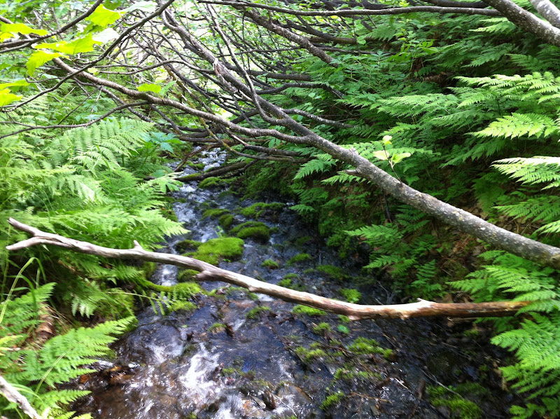
I knew that finding the California Creek trail for the descent was going to be difficult because it is very over-grown. I never did find it. After wandering above brush-line for almost an hour, I finally gave up and picked the drainage that had the shortest distance between open tundra at the top and evergreen canopy at the bottom. Once in the drainage, I found the easiest thing to do was walk in the creek. The California Creek valley is notorious for bears, so I was yelling constantly to overcome the noise of the creek. So, yes, I was doing the same thing these kids did just a few hours later up in the Talkeetnas. [ Shudder ] Just when my feet were going numb from the water, I arrived in the spruce and hemlock forest, which was open for fairly easy walking. I quickly hit “Abe’s Trail” which took me to the California Creek trailhead. It turned out to be a very mild descent by bushwhack standards, and possibly better than the overgrown trail would have been.
I jogged into town and met the family, who had been playing at the Girdwood playground. Unfortunately for them, Dad was a little less than energetic that afternoon.
View Map & Stats on Endomondo
15 miles, 8 hours (includes one mile/one hour of wandering to find Ca. Creek trail)
Notes:
I was glad I went west to east, so that I hit the rocky stuff early when I was still fresh. I was hiking into a decent headwind the whole way, but it wasn’t a big deal. It is nice to end in Girdwood and grab some food. A classic Chugach hike, spoiled slightly by the sight and sound of Seward Highway traffic along the way.
The alarm clock crowed rudely at 4:00 AM. On a Saturday. I fought back by hitting the snooze bar a couple of times.
The Penguin Ridge hike has been on my to-do list for a long time. Tim Kelley first recommended it to me years ago. Like many other local Chugach hikes, I always figured that some weekend, when I had a little extra time, I’ll knock it off my list. But, funny thing, when you have two little rugrats there is never “extra time.” I decided to start at an ungodly hour, so that I could be back on Dad duty by lunch. I left the Bird Creek parking lot just after 5:30 AM.
I knew from previous reports that this ridge offered a lot more vertical and a lot more scrambling than what you can see from the road. But even so, I was surprised how much scrambling there was. I thought that once I got a mile or two past Penguin Peak, I’d be tundra-running the rest of the way. Nope. I should have known better – after all this is the Chugach. The ridge is narrow, rocky and loose enough that you need to go slow, watch your footing, and occasionally scramble, all the way from Penguin Peak until you are directly above the Girdwood turn-off on the highway.
I briefly thought about descending here, as Roman suggests. But I couldn’t resist the urge to see what was around the next corner, then the next… I’m glad I kept going, because the terrain got easier and I could move faster, as the ridge headed northeast, paralleling the road into Girdwood. The terrain is a lot more nuanced here, a wide ridge with lots of tundra-covered rises, depressions and a beautiful lake. Great for running. The scenery is better too, as you are looking away from the highway and into the heart of the Chugach.
 Penguin Ridge Hike – IMG_1212.JPG
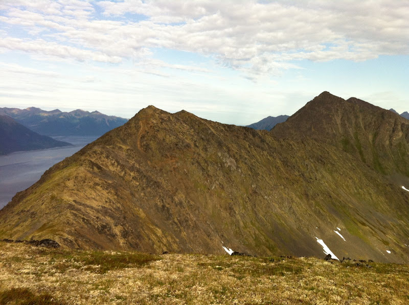
 360 degrees from the top of Penguin Peak
 Penguin Ridge Hike – IMG_1214.JPG
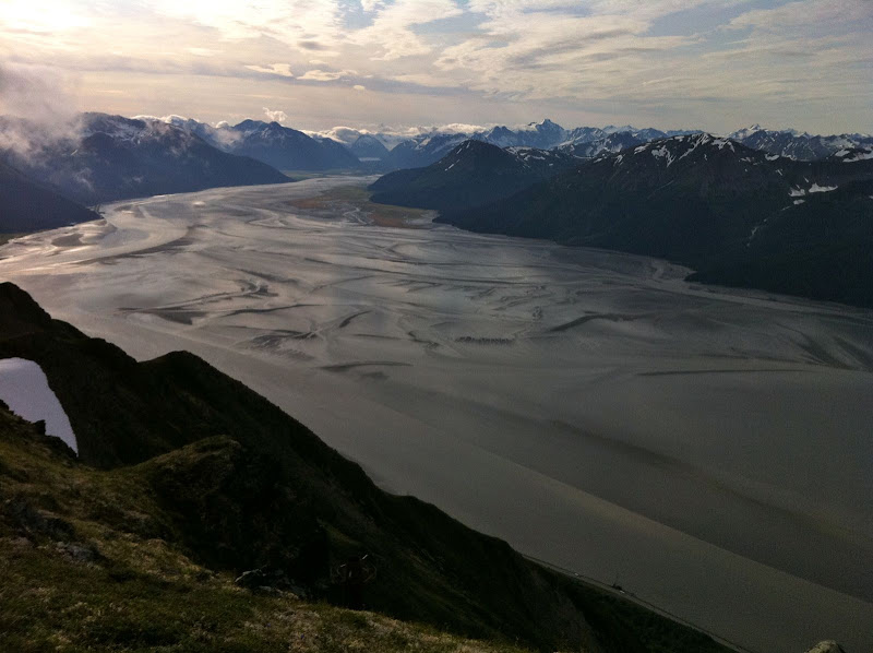 Penguin Ridge Hike – IMG_1215.JPG
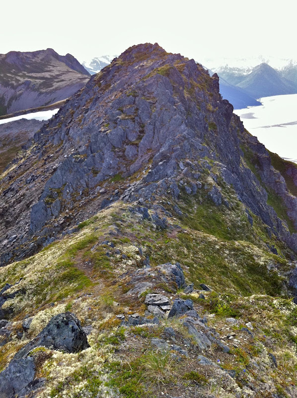 Penguin Ridge Hike – IMG_1217.jpg
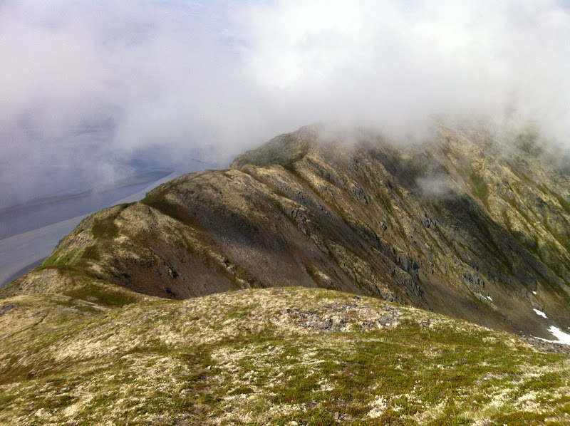 Penguin Ridge Hike – IMG_1222.JPG
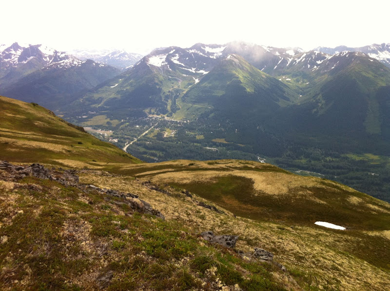 Penguin Ridge Hike – IMG_1225.JPG
I knew that finding the California Creek trail for the descent was going to be difficult because it is very over-grown. I never did find it. After wandering above brush-line for almost an hour, I finally gave up and picked the drainage that had the shortest distance between open tundra at the top and evergreen canopy at the bottom. Once in the drainage, I found the easiest thing to do was walk in the creek. The California Creek valley is notorious for bears, so I was yelling constantly to overcome the noise of the creek. So, yes, I was doing the same thing these kids did just a few hours later up in the Talkeetnas. [ Shudder ] Just when my feet were going numb from the water, I arrived in the spruce and hemlock forest, which was open for fairly easy walking. I quickly hit “Abe’s Trail” which took me to the California Creek trailhead. It turned out to be a very mild descent by bushwhack standards, and possibly better than the overgrown trail would have been.
I jogged into town and met the family, who had been playing at the Girdwood playground. Unfortunately for them, Dad was a little less than energetic that afternoon.
View Map & Stats on Endomondo
15 miles, 8 hours (includes one mile/one hour of wandering to find Ca. Creek trail)
Notes:
I was glad I went west to east, so that I hit the rocky stuff early when I was still fresh. I was hiking into a decent headwind the whole way, but it wasn’t a big deal. It is nice to end in Girdwood and grab some food. A classic Chugach hike, spoiled slightly by the sight and sound of Seward Highway traffic along the way.
The alarm clock crowed rudely at 4:00 AM. On a Saturday. I fought back by hitting the snooze bar a couple of times.
The Penguin Ridge hike has been on my to-do list for a long time. Tim Kelley first recommended it to me years ago. Like many other local Chugach hikes, I always figured that some weekend, when I had a little extra time, I’ll knock it off my list. But, funny thing, when you have two little rugrats there is never “extra time.” I decided to start at an ungodly hour, so that I could be back on Dad duty by lunch. I left the Bird Creek parking lot just after 5:30 AM.
I knew from previous reports that this ridge offered a lot more vertical and a lot more scrambling than what you can see from the road. But even so, I was surprised how much scrambling there was. I thought that once I got a mile or two past Penguin Peak, I’d be tundra-running the rest of the way. Nope. I should have known better – after all this is the Chugach. The ridge is narrow, rocky and loose enough that you need to go slow, watch your footing, and occasionally scramble, all the way from Penguin Peak until you are directly above the Girdwood turn-off on the highway.
I briefly thought about descending here, as Roman suggests. But I couldn’t resist the urge to see what was around the next corner, then the next… I’m glad I kept going, because the terrain got easier and I could move faster, as the ridge headed northeast, paralleling the road into Girdwood. The terrain is a lot more nuanced here, a wide ridge with lots of tundra-covered rises, depressions and a beautiful lake. Great for running. The scenery is better too, as you are looking away from the highway and into the heart of the Chugach.
Penguin Ridge Hike – IMG_1212.JPG
360 degrees from the top of Penguin Peak
Penguin Ridge Hike – IMG_1214.JPG
Penguin Ridge Hike – IMG_1215.JPG
Penguin Ridge Hike – IMG_1217.jpg
Penguin Ridge Hike – IMG_1222.JPG
Penguin Ridge Hike – IMG_1225.JPG
I knew that finding the California Creek trail for the descent was going to be difficult because it is very over-grown. I never did find it. After wandering above brush-line for almost an hour, I finally gave up and picked the drainage that had the shortest distance between open tundra at the top and evergreen canopy at the bottom. Once in the drainage, I found the easiest thing to do was walk in the creek. The California Creek valley is notorious for bears, so I was yelling constantly to overcome the noise of the creek. So, yes, I was doing the same thing these kids did just a few hours later up in the Talkeetnas. [ Shudder ] Just when my feet were going numb from the water, I arrived in the spruce and hemlock forest, which was open for fairly easy walking. I quickly hit “Abe’s Trail” which took me to the California Creek trailhead. It turned out to be a very mild descent by bushwhack standards, and possibly better than the overgrown trail would have been.
I jogged into town and met the family, who had been playing at the Girdwood playground. Unfortunately for them, Dad was a little less than energetic that afternoon.
View Map & Stats on Endomondo
15 miles, 8 hours (includes one mile/one hour of wandering to find Ca. Creek trail)
Notes:
I was glad I went west to east, so that I hit the rocky stuff early when I was still fresh. I was hiking into a decent headwind the whole way, but it wasn’t a big deal. It is nice to end in Girdwood and grab some food. A classic Chugach hike, spoiled slightly by the sight and sound of Seward Highway traffic along the way.
The alarm clock crowed rudely at 4:00 AM. On a Saturday. I fought back by hitting the snooze bar a couple of times.
The Penguin Ridge hike has been on my to-do list for a long time. Tim Kelley first recommended it to me years ago. Like many other local Chugach hikes, I always figured that some weekend, when I had a little extra time, I’ll knock it off my list. But, funny thing, when you have two little rugrats there is never “extra time.” I decided to start at an ungodly hour, so that I could be back on Dad duty by lunch. I left the Bird Creek parking lot just after 5:30 AM.
I knew from previous reports that this ridge offered a lot more vertical and a lot more scrambling than what you can see from the road. But even so, I was surprised how much scrambling there was. I thought that once I got a mile or two past Penguin Peak, I’d be tundra-running the rest of the way. Nope. I should have known better – after all this is the Chugach. The ridge is narrow, rocky and loose enough that you need to go slow, watch your footing, and occasionally scramble, all the way from Penguin Peak until you are directly above the Girdwood turn-off on the highway.
I briefly thought about descending here, as Roman suggests. But I couldn’t resist the urge to see what was around the next corner, then the next… I’m glad I kept going, because the terrain got easier and I could move faster, as the ridge headed northeast, paralleling the road into Girdwood. The terrain is a lot more nuanced here, a wide ridge with lots of tundra-covered rises, depressions and a beautiful lake. Great for running. The scenery is better too, as you are looking away from the highway and into the heart of the Chugach.
Penguin Ridge Hike – IMG_1212.JPG
360 degrees from the top of Penguin Peak
Penguin Ridge Hike – IMG_1214.JPG
Penguin Ridge Hike – IMG_1215.JPG
Penguin Ridge Hike – IMG_1217.jpg
Penguin Ridge Hike – IMG_1222.JPG
Penguin Ridge Hike – IMG_1225.JPG
I knew that finding the California Creek trail for the descent was going to be difficult because it is very over-grown. I never did find it. After wandering above brush-line for almost an hour, I finally gave up and picked the drainage that had the shortest distance between open tundra at the top and evergreen canopy at the bottom. Once in the drainage, I found the easiest thing to do was walk in the creek. The California Creek valley is notorious for bears, so I was yelling constantly to overcome the noise of the creek. So, yes, I was doing the same thing these kids did just a few hours later up in the Talkeetnas. [ Shudder ] Just when my feet were going numb from the water, I arrived in the spruce and hemlock forest, which was open for fairly easy walking. I quickly hit “Abe’s Trail” which took me to the California Creek trailhead. It turned out to be a very mild descent by bushwhack standards, and possibly better than the overgrown trail would have been.
I jogged into town and met the family, who had been playing at the Girdwood playground. Unfortunately for them, Dad was a little less than energetic that afternoon.
View Map & Stats on Endomondo
15 miles, 8 hours (includes one mile/one hour of wandering to find Ca. Creek trail)
Notes:
I was glad I went west to east, so that I hit the rocky stuff early when I was still fresh. I was hiking into a decent headwind the whole way, but it wasn’t a big deal. It is nice to end in Girdwood and grab some food. A classic Chugach hike, spoiled slightly by the sight and sound of Seward Highway traffic along the way.
The alarm clock crowed rudely at 4:00 AM. On a Saturday. I fought back by hitting the snooze bar a couple of times.
The Penguin Ridge hike has been on my to-do list for a long time. Tim Kelley first recommended it to me years ago. Like many other local Chugach hikes, I always figured that some weekend, when I had a little extra time, I’ll knock it off my list. But, funny thing, when you have two little rugrats there is never “extra time.” I decided to start at an ungodly hour, so that I could be back on Dad duty by lunch. I left the Bird Creek parking lot just after 5:30 AM.
I knew from previous reports that this ridge offered a lot more vertical and a lot more scrambling than what you can see from the road. But even so, I was surprised how much scrambling there was. I thought that once I got a mile or two past Penguin Peak, I’d be tundra-running the rest of the way. Nope. I should have known better – after all this is the Chugach. The ridge is narrow, rocky and loose enough that you need to go slow, watch your footing, and occasionally scramble, all the way from Penguin Peak until you are directly above the Girdwood turn-off on the highway.
I briefly thought about descending here, as Roman suggests. But I couldn’t resist the urge to see what was around the next corner, then the next… I’m glad I kept going, because the terrain got easier and I could move faster, as the ridge headed northeast, paralleling the road into Girdwood. The terrain is a lot more nuanced here, a wide ridge with lots of tundra-covered rises, depressions and a beautiful lake. Great for running. The scenery is better too, as you are looking away from the highway and into the heart of the Chugach.
Penguin Ridge Hike – IMG_1212.JPG
360 degrees from the top of Penguin Peak
Penguin Ridge Hike – IMG_1214.JPG
Penguin Ridge Hike – IMG_1215.JPG
Penguin Ridge Hike – IMG_1217.jpg
Penguin Ridge Hike – IMG_1222.JPG
Penguin Ridge Hike – IMG_1225.JPG
I knew that finding the California Creek trail for the descent was going to be difficult because it is very over-grown. I never did find it. After wandering above brush-line for almost an hour, I finally gave up and picked the drainage that had the shortest distance between open tundra at the top and evergreen canopy at the bottom. Once in the drainage, I found the easiest thing to do was walk in the creek. The California Creek valley is notorious for bears, so I was yelling constantly to overcome the noise of the creek. So, yes, I was doing the same thing these kids did just a few hours later up in the Talkeetnas. [ Shudder ] Just when my feet were going numb from the water, I arrived in the spruce and hemlock forest, which was open for fairly easy walking. I quickly hit “Abe’s Trail” which took me to the California Creek trailhead. It turned out to be a very mild descent by bushwhack standards, and possibly better than the overgrown trail would have been.
I jogged into town and met the family, who had been playing at the Girdwood playground. Unfortunately for them, Dad was a little less than energetic that afternoon.
View Map & Stats on Endomondo
15 miles, 8 hours (includes one mile/one hour of wandering to find Ca. Creek trail)
Notes:
I was glad I went west to east, so that I hit the rocky stuff early when I was still fresh. I was hiking into a decent headwind the whole way, but it wasn’t a big deal. It is nice to end in Girdwood and grab some food. A classic Chugach hike, spoiled slightly by the sight and sound of Seward Highway traffic along the way.
The alarm clock crowed rudely at 4:00 AM. On a Saturday. I fought back by hitting the snooze bar a couple of times.
The Penguin Ridge hike has been on my to-do list for a long time. Tim Kelley first recommended it to me years ago. Like many other local Chugach hikes, I always figured that some weekend, when I had a little extra time, I’ll knock it off my list. But, funny thing, when you have two little rugrats there is never “extra time.” I decided to start at an ungodly hour, so that I could be back on Dad duty by lunch. I left the Bird Creek parking lot just after 5:30 AM.
I knew from previous reports that this ridge offered a lot more vertical and a lot more scrambling than what you can see from the road. But even so, I was surprised how much scrambling there was. I thought that once I got a mile or two past Penguin Peak, I’d be tundra-running the rest of the way. Nope. I should have known better – after all this is the Chugach. The ridge is narrow, rocky and loose enough that you need to go slow, watch your footing, and occasionally scramble, all the way from Penguin Peak until you are directly above the Girdwood turn-off on the highway.
I briefly thought about descending here, as Roman suggests. But I couldn’t resist the urge to see what was around the next corner, then the next… I’m glad I kept going, because the terrain got easier and I could move faster, as the ridge headed northeast, paralleling the road into Girdwood. The terrain is a lot more nuanced here, a wide ridge with lots of tundra-covered rises, depressions and a beautiful lake. Great for running. The scenery is better too, as you are looking away from the highway and into the heart of the Chugach.
Penguin Ridge Hike – IMG_1212.JPG
360 degrees from the top of Penguin Peak
Penguin Ridge Hike – IMG_1214.JPG
Penguin Ridge Hike – IMG_1215.JPG
Penguin Ridge Hike – IMG_1217.jpg
Penguin Ridge Hike – IMG_1222.JPG
Penguin Ridge Hike – IMG_1225.JPG
I knew that finding the California Creek trail for the descent was going to be difficult because it is very over-grown. I never did find it. After wandering above brush-line for almost an hour, I finally gave up and picked the drainage that had the shortest distance between open tundra at the top and evergreen canopy at the bottom. Once in the drainage, I found the easiest thing to do was walk in the creek. The California Creek valley is notorious for bears, so I was yelling constantly to overcome the noise of the creek. So, yes, I was doing the same thing these kids did just a few hours later up in the Talkeetnas. [ Shudder ] Just when my feet were going numb from the water, I arrived in the spruce and hemlock forest, which was open for fairly easy walking. I quickly hit “Abe’s Trail” which took me to the California Creek trailhead. It turned out to be a very mild descent by bushwhack standards, and possibly better than the overgrown trail would have been.
I jogged into town and met the family, who had been playing at the Girdwood playground. Unfortunately for them, Dad was a little less than energetic that afternoon.
View Map & Stats on Endomondo
15 miles, 8 hours (includes one mile/one hour of wandering to find Ca. Creek trail)
Notes:
I was glad I went west to east, so that I hit the rocky stuff early when I was still fresh. I was hiking into a decent headwind the whole way, but it wasn’t a big deal. It is nice to end in Girdwood and grab some food. A classic Chugach hike, spoiled slightly by the sight and sound of Seward Highway traffic along the way.
On Sunday I needed to be in Girdwood for dinner, but I had just enough time for a short hike on the way there. I decided to go up Rainbow, which is one of my favorites along Turnagain Arm.
The hike was great, with oodles of unexpected sunshine. I didn’t bring a camera, but when I got to the top, I whipped out my phone and took this picture (click and drag the picture to spin 360 degrees):
Click here for a full screen version.
It took me a long time to succumb to getting a smartphone, but I really enjoy how easy it makes documenting my trips. No longer do I need a camera, cell phone and GPS in my pack (though I still carry a better camera on occasion). It took me about 30 seconds to snap this picture, and it uploaded to the web as I began my decent. The quality is not a good as some of the panoramas I’ve stitched together in Photoshop, but for quick little trips like this it works great.
While we’re on the subject, I’ll share my absolute favorite smartphone app: Endomondo.
This embedded map of my Rainbow hike is very cramped, click here for a full screen version.
Maybe its a hold-over from my years of keeping a training log, or maybe its my fascination with maps, but I love to document my routes. Endomondo makes it easy to map your routes and see all the vital statitics of your workout. It’s as easy as using a stopwatch. There are many, many apps that do this, but Endomondo is my favorite. (In truth, they won me over when I saw that they had both “Roller skiing” and “Orienteering” as workout types.) So now I can keep a record of all my workouts with minimal effort.
One additional cool feature is Live Tracking via the web when you are within cell phone range. So if I get “lost” and my 45 minute run somehow turns into 2 hours (when I am supposed to be watching the kids and cooking dinner), my wife can see exactly where I am (and thus be mad instead of worried). Well, sometimes its a cool feature. Of course, there are privacy settings so you can control who sees your maps.
Oh, and if you try Endomondo, make sure you add me as a “friend.” It is surprisingly motivating to see other peoples workouts. I added this Rainbow hike as a public route, which means you can try to beat my time and become Route Champion! Wahoo!
On Sunday I needed to be in Girdwood for dinner, but I had just enough time for a short hike on the way there. I decided to go up Rainbow, which is one of my favorites along Turnagain Arm.
The hike was great, with oodles of unexpected sunshine. I didn’t bring a camera, but when I got to the top, I whipped out my phone and took this picture (click and drag the picture to spin 360 degrees):
Click here for a full screen version.
It took me a long time to succumb to getting a smartphone, but I really enjoy how easy it makes documenting my trips. No longer do I need a camera, cell phone and GPS in my pack (though I still carry a better camera on occasion). It took me about 30 seconds to snap this picture, and it uploaded to the web as I began my decent. The quality is not a good as some of the panoramas I’ve stitched together in Photoshop, but for quick little trips like this it works great.
While we’re on the subject, I’ll share my absolute favorite smartphone app: Endomondo.
This embedded map of my Rainbow hike is very cramped, click here for a full screen version.
Maybe its a hold-over from my years of keeping a training log, or maybe its my fascination with maps, but I love to document my routes. Endomondo makes it easy to map your routes and see all the vital statitics of your workout. It’s as easy as using a stopwatch. There are many, many apps that do this, but Endomondo is my favorite. (In truth, they won me over when I saw that they had both “Roller skiing” and “Orienteering” as workout types.) So now I can keep a record of all my workouts with minimal effort.
One additional cool feature is Live Tracking via the web when you are within cell phone range. So if I get “lost” and my 45 minute run somehow turns into 2 hours (when I am supposed to be watching the kids and cooking dinner), my wife can see exactly where I am (and thus be mad instead of worried). Well, sometimes its a cool feature. Of course, there are privacy settings so you can control who sees your maps.
Oh, and if you try Endomondo, make sure you add me as a “friend.” It is surprisingly motivating to see other peoples workouts. I added this Rainbow hike as a public route, which means you can try to beat my time and become Route Champion! Wahoo!
On Sunday I needed to be in Girdwood for dinner, but I had just enough time for a short hike on the way there. I decided to go up Rainbow, which is one of my favorites along Turnagain Arm.
The hike was great, with oodles of unexpected sunshine. I didn’t bring a camera, but when I got to the top, I whipped out my phone and took this picture (click and drag the picture to spin 360 degrees):
Click here for a full screen version.
It took me a long time to succumb to getting a smartphone, but I really enjoy how easy it makes documenting my trips. No longer do I need a camera, cell phone and GPS in my pack (though I still carry a better camera on occasion). It took me about 30 seconds to snap this picture, and it uploaded to the web as I began my decent. The quality is not a good as some of the panoramas I’ve stitched together in Photoshop, but for quick little trips like this it works great.
While we’re on the subject, I’ll share my absolute favorite smartphone app: Endomondo.
This embedded map of my Rainbow hike is very cramped, click here for a full screen version.
Maybe its a hold-over from my years of keeping a training log, or maybe its my fascination with maps, but I love to document my routes. Endomondo makes it easy to map your routes and see all the vital statitics of your workout. It’s as easy as using a stopwatch. There are many, many apps that do this, but Endomondo is my favorite. (In truth, they won me over when I saw that they had both “Roller skiing” and “Orienteering” as workout types.) So now I can keep a record of all my workouts with minimal effort.
One additional cool feature is Live Tracking via the web when you are within cell phone range. So if I get “lost” and my 45 minute run somehow turns into 2 hours (when I am supposed to be watching the kids and cooking dinner), my wife can see exactly where I am (and thus be mad instead of worried). Well, sometimes its a cool feature. Of course, there are privacy settings so you can control who sees your maps.
Oh, and if you try Endomondo, make sure you add me as a “friend.” It is surprisingly motivating to see other peoples workouts. I added this Rainbow hike as a public route, which means you can try to beat my time and become Route Champion! Wahoo!
On Sunday I needed to be in Girdwood for dinner, but I had just enough time for a short hike on the way there. I decided to go up Rainbow, which is one of my favorites along Turnagain Arm.
The hike was great, with oodles of unexpected sunshine. I didn’t bring a camera, but when I got to the top, I whipped out my phone and took this picture (click and drag the picture to spin 360 degrees):
Click here for a full screen version.
It took me a long time to succumb to getting a smartphone, but I really enjoy how easy it makes documenting my trips. No longer do I need a camera, cell phone and GPS in my pack (though I still carry a better camera on occasion). It took me about 30 seconds to snap this picture, and it uploaded to the web as I began my decent. The quality is not a good as some of the panoramas I’ve stitched together in Photoshop, but for quick little trips like this it works great.
While we’re on the subject, I’ll share my absolute favorite smartphone app: Endomondo.
This embedded map of my Rainbow hike is very cramped, click here for a full screen version.
Maybe its a hold-over from my years of keeping a training log, or maybe its my fascination with maps, but I love to document my routes. Endomondo makes it easy to map your routes and see all the vital statitics of your workout. It’s as easy as using a stopwatch. There are many, many apps that do this, but Endomondo is my favorite. (In truth, they won me over when I saw that they had both “Roller skiing” and “Orienteering” as workout types.) So now I can keep a record of all my workouts with minimal effort.
One additional cool feature is Live Tracking via the web when you are within cell phone range. So if I get “lost” and my 45 minute run somehow turns into 2 hours (when I am supposed to be watching the kids and cooking dinner), my wife can see exactly where I am (and thus be mad instead of worried). Well, sometimes its a cool feature. Of course, there are privacy settings so you can control who sees your maps.
Oh, and if you try Endomondo, make sure you add me as a “friend.” It is surprisingly motivating to see other peoples workouts. I added this Rainbow hike as a public route, which means you can try to beat my time and become Route Champion! Wahoo!
For the first few years that I lived in Alaska, Scott was my go-to guy for outdoor fun. He was a serious ski racer at that time, but whenever I could distract him from rollerskiing, we’d go do long skis and runs in the mountains. But in 2005, Scott decided he’d rather be an academic […]
Well, it took until mid-August, but I finally got away for a little while. This past weekend, Rob and I both had a free day and a craving to do some packrafting. We decided to go hit the East Fork of the Chulitna river. We’d heard that the East Fork is a great packraft river, […]
This summer has not been what I hoped it would be, on so many levels. The obvious reason is the rainy weather we’ve been having for two months, but really that’s only a small part what’s been going on for me. I’m still dealing with weird health issues. They aren’t as bad as they were […]